
Ararat-Pilot Mountain Local Watershed Plan
Client: NC Division of Mitigation Services
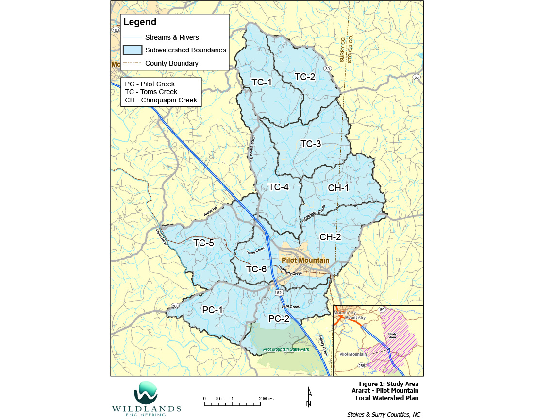
Location: Surry & Stokes Counties, NC
Working with the NC Division of Mitigation Services (DMS), Wildlands developed a Local Watershed Plan (LWP) for a 50-square mile area of the Upper Yadkin River Watershed in the vicinity of the Town of Pilot Mountain in Surry and Stokes Counties. The watershed study area included Heatherly Creek, which is identified on the State 303(d) list as an impaired water due to degraded biological conditions. Wildlands performed GIS analyses of streams, riparian buffers, potential wetland restoration sites, and urban stormwater best management practices (BMPs). Wildlands then developed and implemented a protocol for prioritizing the best potential project sites for stream and wetland mitigation, water quality improvements, and smaller projects that could potentially be implemented by local resource professionals through grant funding. The prioritized sites were ranked by Wildlands and DMS staff, and included in a database of potential projects and a Project Atlas. Wildlands prepared the Watershed Management Plan (WMP) which documents management strategies for the LWP area including highly prioritized project sites as well as recommendations for institutional measures. Wildlands participated in the stakeholder process with presentations and project status updates to the stakeholder group and facilitated the local urban stormwater subcommittee.
Category
Watershed Planning