


Resiliency in Action: The Lower Mud Creek Floodplain Restoration Project
While the state continues to shape the Flood Resiliency Blueprint for the future of North Carolina, cities and towns are already moving forward with projects supported by the first round of funding. The Lower Mud Creek Floodplain Project in Hendersonville is one of them, and it offers a clear example of what flood resilience looks like when planning turns into action.
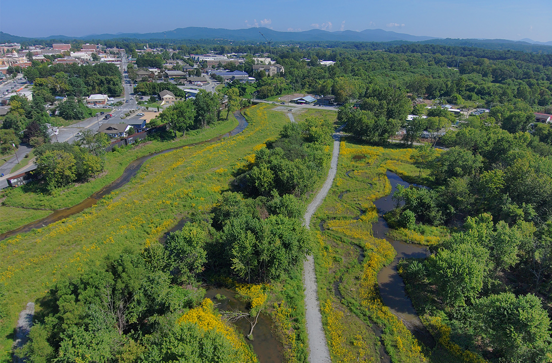
Led by Wildlands’ Asheville team, the Lower Mud Floodplain Restoration Project blends floodplain restoration, ecological design, and public space in a way that goes beyond a typical mitigation site. At its core, the goal is straightforward: create flood storage, reconnect the floodplain, and reduce downstream risk. But achieving that in a dense, historically altered urban corridor has required a layered and innovative approach.
A floodplain shaped by history.
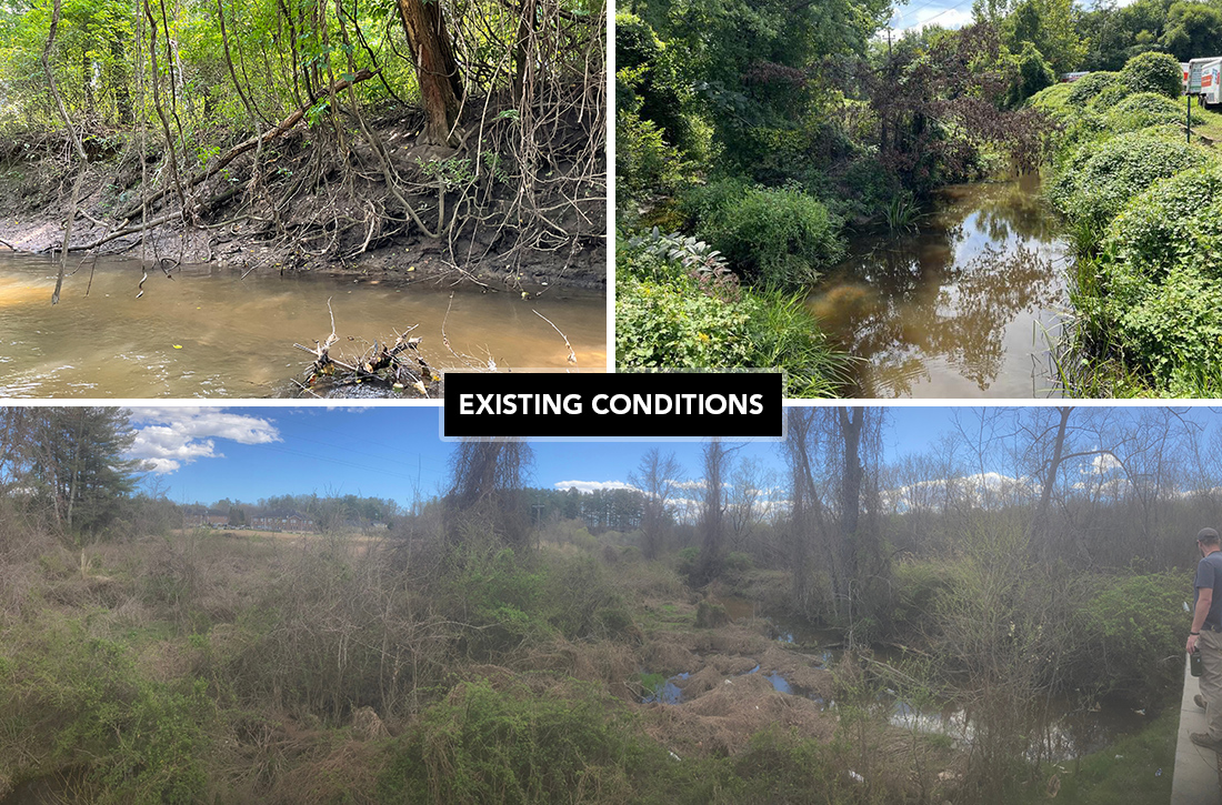
Mud Creek’s story is deeply tied to the region’s past. In 1793, land east of the Pigeon River was taken from the Cherokee people, and development quickly followed. By the early 1900s, the floodplain was being actively altered, with newspaper articles from 1916 describing the “reclamation” of Mud Creek for agriculture and future residential growth. Flooding, however, remained a constant. Large flood events were documented regularly through the mid-20th century (such as the 1916 Flood), underscoring the long-term consequences of disconnecting rivers from their floodplains. A slightly smaller stream, named “Johnsons’ Ditch,” was historically ditched to run parallel to Mud Creek in an attempt to reduce flooding.
The Lower Mud project consists of two project sites on fallow agricultural land purchased by the City of Hendersonville. The work occurring on these sites is, in many ways, an opportunity to reverse some of the historical impacts to local creeks and wetlands while adapting the landscape to modern needs.
More than restoration alone.
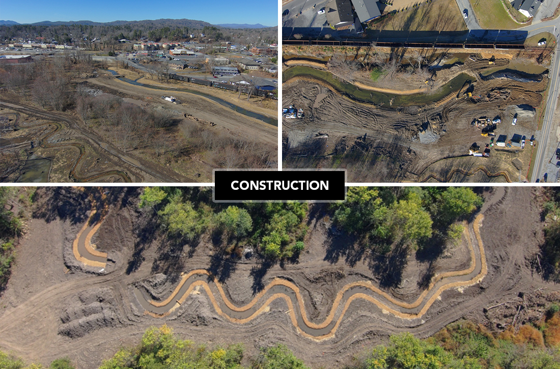
Unlike many stream and wetland restoration projects, this effort is designed explicitly around flood storage, measured in acre-feet, and modeled to analyze how water moves across the landscape during large storm events. The two sites, along different reaches of Mud Creek and Johnsons’ Ditch, work together to provide off-channel storage, reconnect floodplain areas, and reduce peak flows downstream. Other tributaries entering the site have also been restored or had their flow redirected into the extensive wetland system.
The design also had to account for a wide range of constraints: a railroad corridor, sewer infrastructure (with future sewer work predicted during the construction period or shortly after), a development adjacent to one site (currently in the permitting phase), ten- to fifteen-foot-tall berms, invasive plant species, beaver activity, and the presence of unhoused populations along the creek. Rather than working around the floodplain, the project works with it—removing berms, reshaping ditches into functioning stream channels, and reusing excavated material to restore natural grades.
Engineering meets resilience.
To understand how the site functions during flood events, the team collected stream and groundwater data for more than a year and a half, supported by detailed HEC-RAS modeling. This allowed the design team to compare existing conditions to proposed scenarios and quantify how much flood storage the restored floodplain can provide.
Some elements push beyond traditional ecological restoration into environmental engineering territory. Smart water-control features, such as gated weir structures equipped with transducers, allow water levels to be monitored and adjusted in real time. Data can be transmitted to City staff, giving the City of Hendersonville a new level of control and insight during storm events.
A floodplain people can use.
Resilience here isn’t just about water—it’s also about people. Natural-surface and paved trails, pedestrian bridges, lookout points, and connections to Hendersonville’s expanding greenway and rail trail network are built directly into the design. These spaces create opportunities for recreation today while maintaining capacity for flood storage tomorrow. The floodplain is no longer treated as leftover space: it’s an asset.
A glimpse of what’s ahead.
The Lower Mud Floodplain Project brings together floodplain resiliency, ecological restoration, and public space in a way that reflects where flood resilience work is headed. It’s not one solution, but a combination of strategies (storage, connectivity, engineering, and community use) working together.
As North Carolina begins to move from planning to full-delivery flood resilience projects, this site offers a glimpse of what’s possible. And for Wildlands, it represents an evolution of the work we’ve been doing all along, applying ecological restoration expertise in new ways to help communities adapt to a changing future.
“The Lo wer Mud project has been an exciting and innovative design challenge that I’ve worked on for three years now. I’ve enjoyed getting out to the site a few times a week since September to work with Shamrock and the City of Hendersonville to transform the Brevard Church site from a fallow agricultural field into a stream and wetland park with natural-surface trails for the public. It’s so exciting to see the berms removed, the wetland system graded, the streams realigned, and the bridges ‘soon’ to be installed. We have just begun work on the Wilson site, which has a neat twist, as the contractor is able to start from a clean slate and will put lessons learned into practice. I’m looking forward to the springtime, when both sites will be planted, wildlife will be active, and neighbors will be out walking on the trails!” – Julie Fino