Southside Stormwater Improvements Project

Client: RiverLink
Location: Asheville, NC


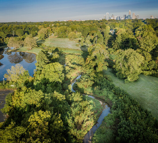
The Southside Stormwater Improvement Project was identified through the Central Asheville Watershed Restoration Plan that Wildlands developed for RiverLink as an area in need of stormwater improvements. Among the many projects identified in this Plan, this project stood out for its need of creating a more functional space, safe environment, and resilient infrastructure at the Erskine Apartments.


After further evaluation of the site and its contributing drainage and infrastructure, a multifaceted project was proposed to address multiple community needs as well as provide stormwater management to improve water quality in Nasty Branch. In addition to the drainage issue, concrete stormwater swales and corrugated metal pipe systems from the original apartment construction in 1969 were failing, a powerline behind residences was very low to the ground creating an unsafe feeling environment, and areas of dense invasive vegetation created unusable spaces and consumed native trees and vegetation. Discussions with community leaders, meetings in the park, and door to door efforts lead to a list of community needs and desires that were assembled into a cohesive improvement plan to address as many considerations as possible.


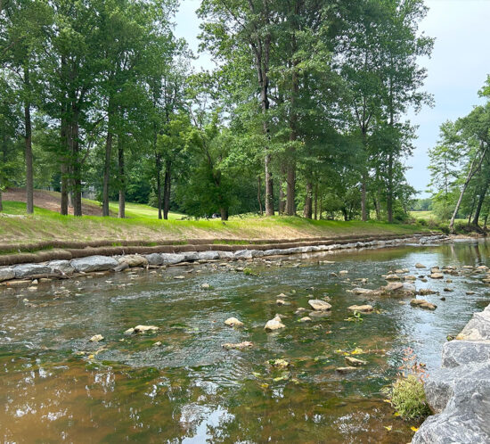
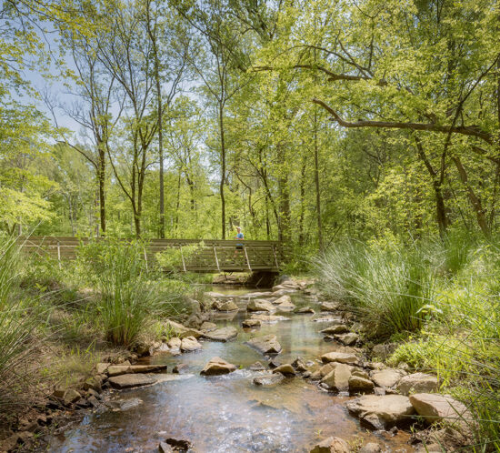
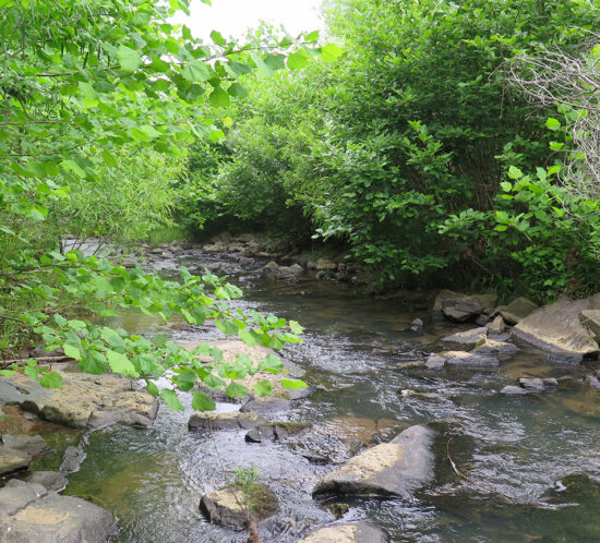
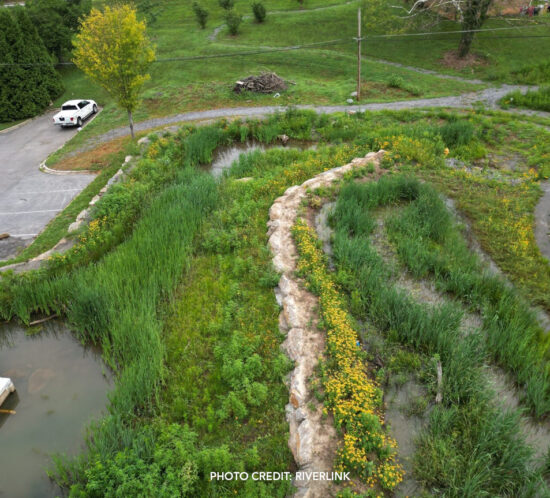
Wildlands helped prepare technical information for grants to fund the project. Multiple entities contributed funding to the project including the apartment owner, the Asheville Housing Authority. The project used stormwater control measures called regenerative stormwater conveyance (RSC) channels to replace pipe and concrete ditches. These incorporate sand-based media to provide additional water quality treatment. Rain gardens and a stormwater wetland were implemented to capture parking lot and rooftop runoff; a french drain routed subsurface flow into the stormwater system to resolve road seepage; a power line relocation addressed the low overhead line; and trails and sitting areas for contemplation and to honor lost loved ones were incorporated into the project. The paths and a bridge over the RSC channel connect kids and community members to the nearby park, community center, school bus stops, and other nearby destinations.


Click here to visit RiverLink’s project page »

Little Sugar Creek Environmental Restoration Projects

Client: Charlotte-Mecklenburg Storm Water Services
Location: Charlotte, NC


To date, Wildlands has completed the design and construction administration for stream enhancement work on five separate reaches of Little Sugar Creek in Charlotte. The Midtown, Kings Drive, and Elizabeth reaches were constructed in conjunction with a greenway and linear park development adjacent to Uptown Charlotte. The project, which extended over multiple phases and eight years of design and construction, involved extensive stakeholder coordination which helped shape the project design vision. The stakeholder group includes Charlotte-Mecklenburg Storm Water Services, Park & Recreation, Real Estate Services, City of Charlotte, and the North Carolina Land and Water Fund (formerly Clean Water Management Trust Fund). This high-profile work revitalized the corridor and played a significant role in spurring infill residential and commercial development both along the corridor and in the surrounding neighborhoods. The projects not only improved the aesthetics but also provide natural recreation outlets for citizens living in a densely urban area.

Each project included detailed hydrulic modeling for a no impact certification in support of a FEMA floodplain development permit.


Midtown Reach, Kings Drive Reach and Elizabeth Reach:
These high-profile, progressive stream projects daylighted 1,800 LF of buried stream channel and incorporated natural restoration elements to 4,800 LF of Little Sugar Creek. The project corridor is highly urban and featured multiple utility and roadway constraints. The stream and floodplain enhancement design was integrated into the adjacent greenway and park design and used strategically placed in-stream boulder structures and excavated floodplain benches to improve the stability, habitat, and aesthetics of the stream corridor. Swaths of native plantings were used to provide terrestrial habitat while maintaining a landscaped feel.


Little Sugar Creek Enhancement at Cullman Avenue:
Located in the popular North Davidson (NoDa) Arts Neighborhood, this project restored 1,130 LF of stream and developed a bioretention area to treat 0.9 acres of off-site drainage. Public meetings with local residents and business owners were conducted to rally the community around the project.


Little Sugar Creek Greenway: I-485 to Polk Historic Site:
This segment of Little Sugar Creek flows through a highly urbanized section of Pineville, NC and exhibited poor water quality. Wildlands provided design, permitting, and construction administration services for approximately 9,300 LF of stream enhancement in conjunction with two miles of multi-use greenway. Stream enhancement consisted of bank protection, bed stabilization, and buffer establishment through installation of in-stream structures and bio-engineering techniques. Construction was completed in September 2020.

Gilder Creek Stream Enhancement and Infrastructure Protection Project

Client: Renewable Water Resources (ReWa)
Location: Greenville County, SC


Wildlands was selected by Renewable Water Resources (ReWa) to develop site-specific natural channel design and bioengineering techniques for an urban bank stabilization project. Wildlands’ stream enhancement design included bank grading and stabilization using geolifts and boulder toe structures. This led to 1,400 linear feet of stream stabilization, which provides aesthetic value to the stream for adjacent homeowners and golf course. Wildlands also implemented grade control and channel bed stability to protect sewer infrastructure across the stream. This project included construction within state and federal jurisdictional aquatic resources and necessitated federal and state authorization through Sections 401 and 404 of the Clean Water Act.

Hendersonville Multi-Area Streambank Restoration Project

Client: City of Hendersonville
Location: Hendersonville, NC


The Multi‐Area Streambank Restoration Project is a City of Hendersonville (City) initiative to restore approximately 11,000 linear feet of streambanks at 13 sites throughout the City. The project purpose is to protect sanitary sewer and other City infrastructure and improve water quality in Mud Creek, an impaired stream on the state’s 303(d) list using a green infrastructure-focused approach. Grant funding through the Division of Water Infrastructure (DWI) requires state review of the project bid package and the acquisition of easements on each parcel.


Wildlands collaborated with the City to select a variety of approaches to address site needs and existing conditions including natural channel design, buffer enhancement, stormwater retrofits, and streambank restoration and stabilization measures. Project components included site assessment, a preliminary design, community outreach, project easement development, final design, permitting, construction oversight and monitoring. Construction was completed in 2021.


Wildlands used ArcGIS online and other cloud-stored data to facilitate easements and outreach and during the construction phase to track progress and post site photos and punch list items.


As part of the project, sites were evaluated for threatened and endangered species, jurisdictional determination (stream and wetland delineation), and 404/401 and floodplain development permits were obtained for the majority of sites. Six flood studies and hydraulic analysis reports were completed to support floodplain development permits. An erosion control permit was obtained for the project.

Reedy Creek Stream Restoration Project

Client: Charlotte-Mecklenburg Storm Water Services
Location: Charlotte, NC


Wildlands was selected to perform the first design-build project to generate stream and wetland mitigation units for the City of Charlotte Umbrella Stream and Wetland Mitigation Bank. This pilot project is located within the environmentally significant Reedy Creek Nature Preserve and involved the restoration of deeply incised, eroded stream channels to appropriately sized bankfull channels with access to a floodplain and preservation of existing high-quality streams and wetlands. The project consists of approximately 26,400 linear feet (LF) of stream restoration and 15,600 LF of stream preservation for a total of 25,974 stream mitigation credits. Approximately 1.0 wetland mitigation unit will be accomplished through enhancement and preservation of wetlands.


Due to the location of the Reedy Creek project in an active park, Wildlands is coordinating directly with Mecklenburg County Park & Recreation on issues that affect the Reedy Creek Nature Preserve’s day-to-day use. Wildlands is also coordinating with research efforts being conducted by UNC-Charlotte. This coordination effort is a great demonstration of Wildlands’ ability to coordinate with stakeholders as well as the general public to facilitate project implementation. Construction was completed in February of 2019.


CLICK HERE to check out the project website (designed and developed by Wildlands).

Chantilly Ecological Sanctuary at Briar Creek

Client: Charlotte-Mecklenburg Storm Water Services
Location: Charlotte, NC


Mecklenburg County Storm Water Services and Charlotte-Mecklenburg Storm Water Services partnered on this stream restoration and enhancement and stormwater quality retrofit project along Briar Creek in a densely urban area of the City of Charlotte. The overall goals of the project were to restore Briar Creek, Edwards Branch, and the Chantilly Tributary, improve water quality through improved stormwater management, and obtain stream mitigation credits for the City of Charlotte’s Umbrella Mitigation Bank. Prior to the project, the Doral and Cavalier apartment complexes were located within the 100-year floodplain of the project site. Mecklenburg County purchased and removed the flood-prone buildings as part of the FEMA flood mitigation buyout program, which provided the space necessary to expand the existing community park, incorporate stormwater quality retrofits, and restore portions of degraded streams. Over 4,400 linear feet of stream restoration and enhancement was performed, two stormwater quality best management practices (BMPs) were installed within the floodplain of Briar Creek, and the ground was prepared for greenway and recreational trails to be expanded in the future. Wildlands’ scope included design of a replacement sewer line under a reach of restored stream between two manholes. Extensive hydraulic analysis was required to support a floodplain no-rise certification. Wildlands also prepared a feasibility study and an alternatives analysis for the Chantilly Tributary and BMP components of the project. Wildlands Realty, our in-house realty firm, negotiated five donated stormwater easements on private parcels. Construction was completed in 2018.


Torrence Creek at Huntersville Business Park Stream and Water Quality Enhancement

Client: Charlotte-Mecklenburg Storm Water Services
Location: Huntersville, NC


Torrence Creek at Huntersville Business Park is an urban stream and water quality enhancement project in Huntersville, NC. The project began with a feasibility study to evaluate alternatives and has included assessment, design, permitting, hydraulic modeling and bid phase assistance. Reach 1 of the project is tightly constrained and was  enhanced within the existing channel. A landscaped look was planned for this higher profile reach. Reach 2 flows through a wooded wetland area that allowed for a meandering restoration approach. Hydraulic modeling was used to design the channel to achieve a no rise condition. Stakeholders included commercial property managers in The Park, Town of Huntersville, and the NC Clean Water Management Trust Fund. Construction was completed in June 2013 and floodplain planting was completed in February 2014.


wetland mitigation identification and prioritization

Wetland Mitigation Identification and Prioritization Project

Client: Charlotte-Mecklenburg Storm Water Services
Location: Charlotte, NC


Wildlands performed a wetland mitigation identification and prioritization project for Charlotte-Mecklenburg Storm Water Services. The primary goal of the project was to identify wetland restoration and preservation sites within the 524-square mile county area that may be used to provide mitigation credit to the City of Charlotte’s Umbrella Mitigation Bank. The site identification and prioritization process included both GIS analysis and field assessment. A project-specific scoring system was used to prioritize potential project sites. Ultimately, a summary report was developed for each potential wetland mitigation site that described the site’s existing conditions, possible constraints to implementation, and Wildlands’ recommendations for potential restoration or enhancement approaches. These reports demonstrated to City staff how each site ranked in terms of project feasibility, potential for functional lift, and the amount of possible wetland credit that may be created for the City’s Umbrella Mitigation Bank.