Carolina Crossroads Permittee-Responsible Mitigation Project

Client: SCDOT
Location: Newberry and Laurens Counties, SC


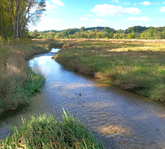
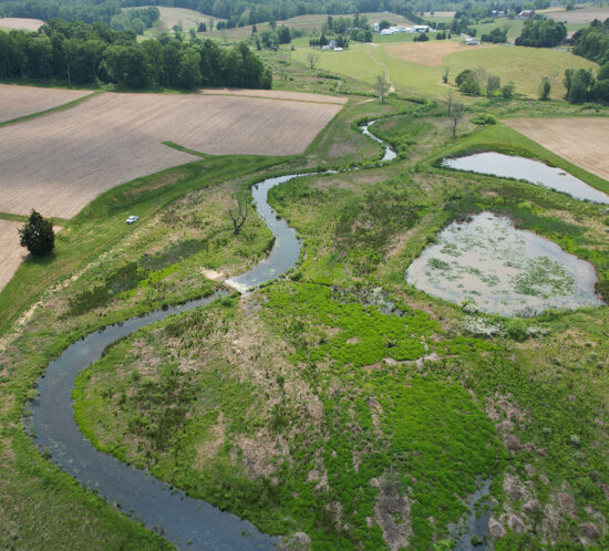
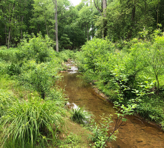
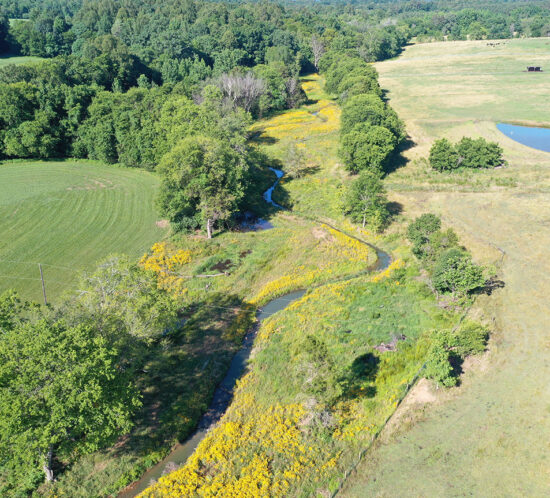
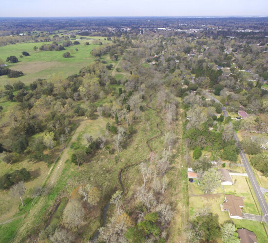
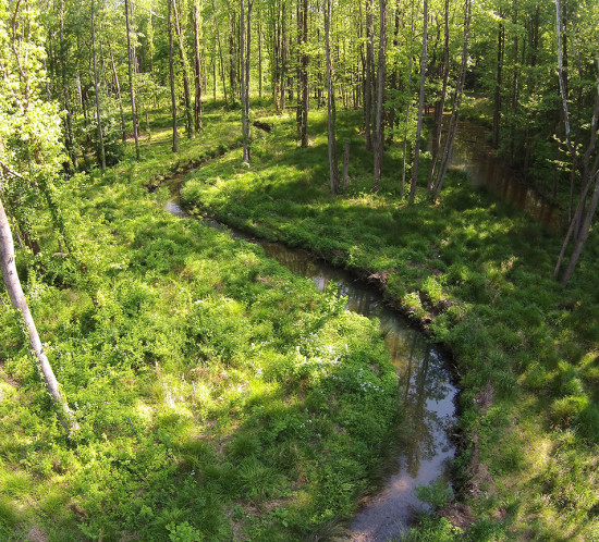
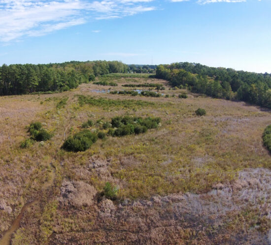
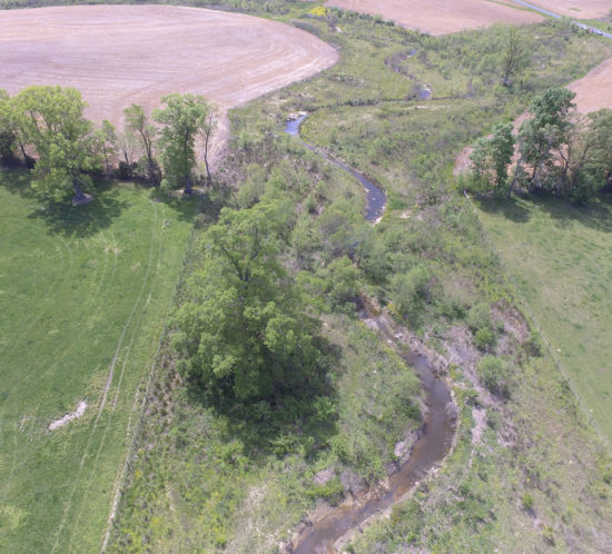
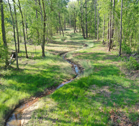
Located in the heart of South Carolina, the Carolina Crossroads I-20/26/126 Corridor Improvement Project is the number one interstate priority for the state of South Carolina (https://lnkd.in/euFJQc2). Construction of the Carolina Crossroads project required unavoidable impacts to waters (of the U.S.) under the jurisdiction of the U.S. Army Corps of Engineers as regulated by Section 404 of the Clean Water Act. The South Carolina Department of Transportation evaluated multiple mitigation alternatives and offset aquatic resource impacts through the restoration, enhancement, and protection of more than 80,000 linear feet of stream and the protection of more than 8.6-acres of wetlands. Approximately 10% of these reaches were ephemeral channels. This large-scale and unique mitigation project protects more than 2,600-acres of land adjacent to the South Carolina Department of Natural Resources’ Belfast Wildlife Management Area which will provide future public use and wildlife management benefits. Wildlands led design, mitigation plan development, generated the construction documents, and oversaw construction at the mitigation site. Construction activities associated with the mitigation site were completed in 2022 to generate the required mitigation for this priority project. Wildlands is currently providing post-construction monitoring at the mitigation site.

Hendersonville Multi-Area Streambank Restoration Project

Client: City of Hendersonville
Location: Hendersonville, NC


The Multi‐Area Streambank Restoration Project is a City of Hendersonville (City) initiative to restore approximately 11,000 linear feet of streambanks at 13 sites throughout the City. The project purpose is to protect sanitary sewer and other City infrastructure and improve water quality in Mud Creek, an impaired stream on the state’s 303(d) list using a green infrastructure-focused approach. Grant funding through the Division of Water Infrastructure (DWI) requires state review of the project bid package and the acquisition of easements on each parcel.


Wildlands collaborated with the City to select a variety of approaches to address site needs and existing conditions including natural channel design, buffer enhancement, stormwater retrofits, and streambank restoration and stabilization measures. Project components included site assessment, a preliminary design, community outreach, project easement development, final design, permitting, construction oversight and monitoring. Construction was completed in 2021.


Wildlands used ArcGIS online and other cloud-stored data to facilitate easements and outreach and during the construction phase to track progress and post site photos and punch list items.


As part of the project, sites were evaluated for threatened and endangered species, jurisdictional determination (stream and wetland delineation), and 404/401 and floodplain development permits were obtained for the majority of sites. Six flood studies and hydraulic analysis reports were completed to support floodplain development permits. An erosion control permit was obtained for the project.

Marylea Farm Stream Restoration Project

Client: Maryland State Highway Association
Location: Harford County, MD


Under Maryland State Highway Association’s first full-delivery contract for stream restoration services, Wildlands completed construction on the Marylea Farm Stream Restoration project in Harford County, MD in May 2020. The project restored 9,470 linear feet of stream on Thomas Run and three unnamed tributaries in the Chesapeake Bay Watershed. Thomas Run and its tributaries are classified as “recreational trout waters,” so the design of Thomas Run and the lower gradient tributary reaches consisted of riffles and pools that incorporate large woody debris, boulders, brush, and lunker structures to enhance aquatic habitat. The steeper tributary reaches incorporate boulder steps and cascades with deep pools to provide additional aquatic habitat.


The 32-acre conservation easement preserves four archaeological sites containing Native American artifacts as well as existing wetlands, some of which provide potential habitat for the northern bog turtle. The riparian buffer was planted along the stream channels with early successional native vegetation comprised of trees, shrubs, and herbaceous species. Small areas around the planting perimeter were seeded with native wildflowers to provide habitat for the monarch butterflies, which were prevalent at the site preconstruction. By closeout, the project will provide 9,885 credits towards the State Highway Administration’s program to comply with the Chesapeake Bay TMDL and their MS4 permit.


Big Harris Creek Design-Build Stream Mitigation Project

Client: NC Division of Mitigation Services (DMS)
Location: Cleveland County, NC


Wildlands Engineering served as the prime consultant on the project design, organizing a multifaceted design and construction team including two design consultants, two contractors, and multiple subcontractors to complete the project. The project includes the restoration and enhancement of approximately 39,150 linear feet (LF) of degraded stream channels. Additionally, nine storm water Best Management Practices (BMPs) were constructed to stabilize gully erosion, treat agricultural runoff, and improve water quality. The project will provide 25,836 stream credits in the Broad River watershed and will protect approximately 145 acres of streams and riparian buffers in perpetuity via a conservation easement recorded by DMS. Project construction began in the spring of 2017 and took nearly 14 months to complete. Wildlands negotiated mitigation credit development with the NC Interagency Review Team to recognize a lighter touch and watershed-scale approach. The project’s multifaceted, watershed approach toward mitigation is one of the first of its kind in North Carolina. The site will continue to be monitored for a five-year term, which includes additional water quality monitoring provided by Western Carolina University.

Buckwater Full-Delivery Mitigation Project

Client: NC Division of Mitigation Services
Location: Orange County, NC


This stream mitigation site is located northeast of Hillsborough, NC. At closeout, the project is expected to provide 12,489 stream credits on Buckwater Creek and 14 unnamed tributaries in the Neuse River basin via stream restoration and enhancement. The project includes categorical exclusion documentation, existing conditions assessment, landowner coordination, conservation easement acquisition, stream and wetland restoration design, permitting, construction, and seven years of post-construction monitoring.

Vile Creek Full-Delivery Mitigation Project

Client: NC Division of Mitigation Services
Location: Alleghany County, NC


Wildlands has restored a mountain stream and wetland complex on a cattle farm near the Town of Sparta, NC. The project elements include (1) restoration and enhancement to 7,927 feet of streams; (2) 3.0 acres of wetlands enhancement and 3.5 acres of wetlands creation; and (3) expansion and improvement of 2.0 acres of Southern Appalachian Bog habitat, which is intended to support populations of bog turtles. USFWS and North Carolina Wildlife Resources Commission (NCWRC) biologists identified existing habitat within multiple linear man-made ditches across the site. These ditches were plugged to retain water on the site and widened to expand the bog conditions suitable for the turtles. In addition, Little River is a hatchery-supported trout stream stocked by the NCWRC. While there are no immediate plans to stock trout, Vile Creek is large enough to hold trout that migrate from Little River; therefore, the design goals also included enhancement of fish habitat. Long-term (post-monitoring period) management of the bog habitat is being coordinated with third party organizations, such as the NCWRC and/or the Bog Learning Network.

Cannon Creek Mitigation Project

Client: Berkeley County, South Carolina Department of Transportation (SCDOT)
Location: Berkeley County, SC


In January 2013, Berkeley County (County) solicited proposals for coastal stream mitigation to support projects funded by the County’s One Cent Local Option Sales Tax. The ‘full-delivery mitigation’ solicitation, managed by the SCDOT, was only the second to be issued in the state of South Carolina and has allowed local municipalities and the SCDOT to contract for turn-key mitigation where mitigation credits were not readily available, expedite USACE permitting timelines, focus on core competencies (transportation infrastructure improvement), and transfer the development and risk of mitigation to the private mitigation sector.

The Cannon Creek Mitigation Site provides stream mitigation credits in the Cooper River watershed and Mid-Atlantic Coastal Plain. Cannon Creek was a degraded incised coastal plain stream system which provided limited habitat diversity. Nutrients and stormwater runoff were discharged directly into Cannon Creek and conveyed into the Cooper River; a 303d listed waterbody. The project restored 4,764 linear feet of Cannon Creek and its tributaries. Improved in-stream and terrestrial (riparian) habitats were provided, along with improved stream stability, reduced risk of sewer infrastructure encroachment, and improved hydrologic function. Nutrient and sediment reduction is being provided through vegetative buffering, cattle exclusion, and relocation of the stream away from the sanitary sewer line and residential backyards. Excavation of a new floodplain at a lower elevation allows for frequent floodplain inundation, nutrient filtration, and reduced loadings to the Cooper River. Construction was completed in 2015 and Wildlands is currently conducting five years of post-construction monitoring.

Little Troublesome Creek Mitigation Project

Little Troublesome Creek Full-Delivery Mitigation Project

Client: NC Division of Mitigation Services
Location: Rockingham County, NC


Wildlands has restored this stream and wetland site that is surrounded by forested land and was previously used for corn production. A large shopping center is located immediately north of the site, with an active railroad running along the eastern edge of the project boundary. The project will provide 4,902 stream mitigation units and 13.4 wetland mitigation units in the Cape Fear River basin. The project includes categorical exclusion documentation, existing conditions assessment, landowner coordination, conservation easement acquisition, stream and wetland restoration design, permitting, construction, and five years of post-construction monitoring. Because Little Troublesome Creek is located in a mapped floodplain, Wildlands performed detailed hydraulic modeling of the proposed restoration design for a CLOMR to satisfy FEMA requirements. Construction of the project was completed in the spring of 2012. The project is currently in the monitoring phase.


Malbone Mitigation Project

Client: Virginia Department of Transportation
Location: City of Virginia Beach, VA


This Wildlands-designed wetland mitigation project was constructed during the summer of 2010 for the Virginia Department of Transportation. The site was selected for enhancement and creation of three wetland types (emergent, scrub-shrub, and forested) to mitigate for wetland impacts resulting from the proposed widening of Princess Anne Road and the construction of Nimmo Parkway. Approximately 24 acres of wetlands were created or enhanced as a result of the project. This includes 16 acres of palustrine forested wetland creation, three acres of palustrine emergent wetland creation, 0.1 acres of scrub-shrub wetland creation and five acres of palustrine emergent wetlands enhancement. Key elements of the project included soil classification and analysis, groundwater monitoring, well installation and monitoring, wetland hydrologic modeling, grading design, permitting, construction document development, construction oversight, as-built plan development, baseline monitoring, and ten years of post-construction monitoring to document hydrologic and vegetative success and remediation if necessary. This project was successfully closed out in 2021.


NC stream mitigation

Norkett Branch Full-Delivery Mitigation Project

Client: NC Division of Mitigation Services
Location: Union County, NC


Wildlands developed this full-delivery project in rural Union County on Norkett Branch and four tributaries. The project provided 10,098 stream mitigation units for the NC Division of Mitigation Services. The project included existing site assessment, conservation easement acquisition, permitting, stream restoration design, construction, and seven years of post-construction monitoring of geomorphic stability and vegetation. Detailed hydraulic modeling was completed for both CLOMR and LOMR approvals. Two stormwater BMPs were constructed to treat headwater agricultural runoff and provide stream credits. Construction of the project was completed in April 2014. The project successfully closed out in 2021.