Central Asheville Watershed Restoration Plan

Central Asheville Watershed (CAW) Restoration Plan

Client: Riverlink
Location: Asheville, NC


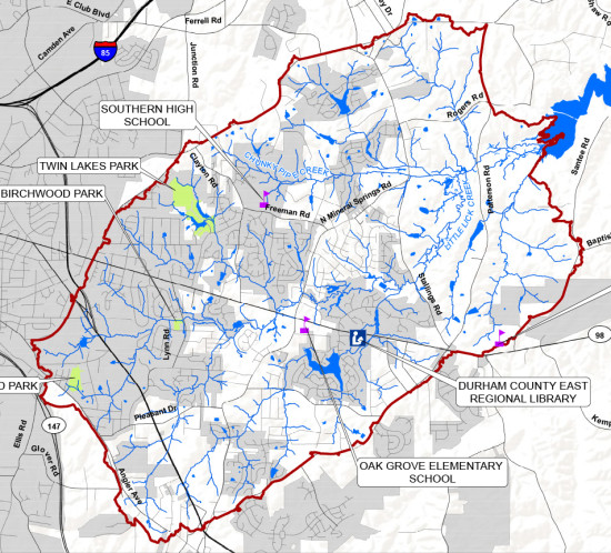
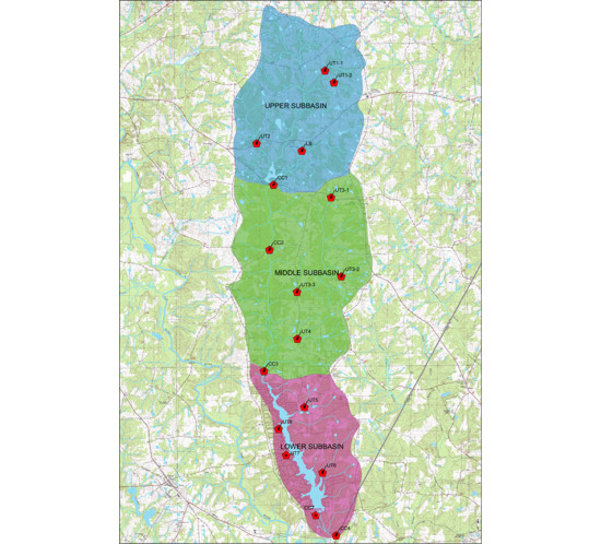
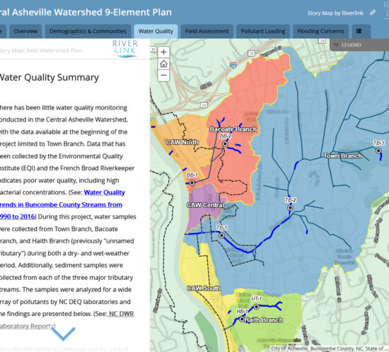
Wildlands developed this web-based, GIS-centric watershed plan for the CAW in ArcGIS online (AGOL). The CAW 9-element watershed plan encompasses several urban tributaries that drain the River Arts District (RAD) and a large portion of downtown Asheville to the French Broad River. This roughly two-square mile watershed was a priority for RiverLink due to its complex environmental, economic, and social equity issues. The streams covered in the plan – Town Branch, Bacoate Branch, and Haith Branch – are all impacted by numerous issues, including stormwater runoff from developed areas, piped streams, and aging infrastructure. Major watershed stressors identified during the assessment include:

  • Impervious surface runoff
  • Erosion and stream sedimentation
  • Flooding
  • Bacteria
  • Illicit discharges
  • Metals and petroleum compounds
  • Trash
  • Invasive plant species

Over 75 potential watershed improvement projects were identified that would contribute to the watershed restoration goals; and two of the three major tributaries draining the CAW will be recommended for inclusion on the 303(d) list of impaired waters for fecal coliform bacteria by NCDENR. Overall data integration, field data collection, and spatial decision support for the entire project team was facilitated by Wildlands through a combination of AGOL web and mobile device applications throughout every phase of watershed plan development. AGOL was, and will continue to be, used as a data hub from which to store, create, manage, retrieve, and disseminate real-time watershed planning information for the CAW by RiverLink and several participating stakeholders, including the City of Asheville. The plan targeted ways to create more seamless linkages between various data sources already being gathered at the municipal and regional level in order to bring more robust data together for this and future watershed planning efforts. Map journal is featured below or click on the following link: https://bit.ly/3i141jS


Watershed Improvement Plan

Little Lick Creek Watershed Improvement Plan

Client: City of Durham
Location: Durham, NC


Wildlands is leading watershed planning services to improve the water quality and watershed health of Little Lick Creek, a State 303(d) listed water body for impaired conditions that flows into Falls Lake, a nutrient-sensitive water supply reservoir with an established TMDL for nutrients (total nitrogen and total phosphorus). The watershed improvement plan includes the following main components:


  • Assessment of the existing conditions of over 24 miles of streams with identification of potential stream restoration, enhancement, and stabilization projects
  • Assessment of 61 existing stormwater control facilities to determine if retrofits can improve their water quality benefits
  • Feasibility assessment of installing new stormwater quality facilities at 100 sites in developed areas with no stormwater control facilities as retrofits to the existing drainage system
  • Development of a watershed-scale hydrologic and hydraulic (SWMM) and water quality (WARMF) models to assess the effectiveness of individual and multiple water quality improvement projects
  • Comprehensive public education and outreach program, including public meetings, social media postings, and public education videos
  • Design of four stormwater retrofits: three regenerative stormwater conveyances (RSCs) and one bioretention area
  • Production of a Watershed Improvement Plan document that meets the nine elements of an EPA-approved watershed plan


wetland mitigation identification and prioritization

Wetland Mitigation Identification and Prioritization Project

Client: Charlotte-Mecklenburg Storm Water Services
Location: Charlotte, NC


Wildlands performed a wetland mitigation identification and prioritization project for Charlotte-Mecklenburg Storm Water Services. The primary goal of the project was to identify wetland restoration and preservation sites within the 524-square mile county area that may be used to provide mitigation credit to the City of Charlotte’s Umbrella Mitigation Bank. The site identification and prioritization process included both GIS analysis and field assessment. A project-specific scoring system was used to prioritize potential project sites. Ultimately, a summary report was developed for each potential wetland mitigation site that described the site’s existing conditions, possible constraints to implementation, and Wildlands’ recommendations for potential restoration or enhancement approaches. These reports demonstrated to City staff how each site ranked in terms of project feasibility, potential for functional lift, and the amount of possible wetland credit that may be created for the City’s Umbrella Mitigation Bank.


Ararat-Pilot Mountain Local Watershed Plan

Ararat-Pilot Mountain Local Watershed Plan

Client: NC Division of Mitigation Services
Location: Surry & Stokes Counties, NC


Working with the NC Division of Mitigation Services (DMS), Wildlands developed a Local Watershed Plan (LWP) for a 50-square mile area of the Upper Yadkin River Watershed in the vicinity of the Town of Pilot Mountain in Surry and Stokes Counties. The watershed study area included Heatherly Creek, which is identified on the State 303(d) list as an impaired water due to degraded biological conditions. Wildlands performed GIS analyses of streams, riparian buffers, potential wetland restoration sites, and urban stormwater best management practices (BMPs). Wildlands then developed and implemented a protocol for prioritizing the best potential project sites for stream and wetland mitigation, water quality improvements, and smaller projects that could potentially be implemented by local resource professionals through grant funding. The prioritized sites were ranked by Wildlands and DMS staff, and included in a database of potential projects and a Project Atlas. Wildlands prepared the Watershed Management Plan (WMP) which documents management strategies for the LWP area including highly prioritized project sites as well as recommendations for institutional measures. Wildlands participated in the stakeholder process with presentations and project status updates to the stakeholder group and facilitated the local urban stormwater subcommittee.


Watershed Management Plan

Neuse River 01 Regional Watershed Management Plan: Phase I & II

Client: NC Division of Mitigation Services
Location: Multiple Counties in NC


The Neuse 01 Regional Watershed Management Plan (RWP) study area encompasses 580 square miles of one of the most developed portions of North Carolina. Population growth and associated rapid development and future completion of the I-540 highway loop are major drivers for this watershed planning effort.


PHASE 1: Wildlands completed Phase I of the RWP in 2014, which included a preliminary assessment of ecological and water quality conditions based on GIS data, the prioritization of subwatersheds for more detailed assessments, development of monitoring and modeling strategies for Phase II, and identification of potential watershed improvement projects, including traditional stream, wetland, and riparian buffer restoration, urban stormwater BMPs, habitat preservation, and removal of barriers to fish passage.


PHASE 2: Wildlands has recently completed Phase II of the RWP. This phase included the application of Pilot Study Areas to determine the best combinations of potential projects to offset watershed stressors. Wildlands evaluated potential projects and developed multiple project concepts to demonstrate the types of treatment practices recommended. These included clusters of different practices to offset combinations of watershed stressors. Wildlands also coordinated a large stakeholder advisory group consisting of resource agency staff, local municipal representatives, county planners, and conservation district personnel. View the web map that Wildlands created for DMS, the stakeholder advisory group, and the public »


Cypress Creek Watershed Plan

Client: The Conservation Consultant
Location: Franklin County, NC


The Cypress Creek Watershed Plan involved a watershed characterization and preliminary engineering study of potential watershed improvement projects. Existing water quality, hydrology, and GIS data for the 31- square mile watershed were collected and analyzed by Wildlands. Streams were evaluated at 15 road crossings for lateral and vertical stability, aquatic and riparian habitat, and human impacts. The suitability of the channels for preservation, enhancement or restoration was determined from the data collected. The information was compiled into a GIS database.


Water quality stressors were also identified within the watershed and potential opportunities for improvements, with a specific focus on structural best management practices (BMPs), were located. The potential opportunities were ranked based on planning level cost estimates, general physical and regulatory constraints, known private property interests, and political support. The watershed assessment data and GIS mapping were used to identify the BMP project that directly addressed the greatest stressor for water quality in Cypress Creek, and could serve as a demonstration site and a replicable model for other watersheds in Franklin County. A conceptual design was developed for the selected BMP.